
Calm weather was predicted – finally! For most of our time in the Bahamas, the Atlantic had pounded the east side of the islands, and therefore the coral reefs, so we hadn’t had the scuba diving opportunities we’d been hoping for. For the next several days, no wind and no waves were expected, so we departed Green Turtle Cay and headed for Moraine Cay. We saw one boat “sailing” that looked like they were sitting still, so we kept the motor running. But even the clang-clang-clang of our motor couldn’t keep us from enjoying the Gatorade-blue water.

Moraine Cay is a private island – you can rent a villa there and have it all to yourself! Or you can purchase it for less than $3 million! There is a fair weather anchorage marked on the charts on the southeast side of the island. Even with the ocean laying flat and looking like a swimming pool, our boat still rocked with the slightest motion of the sea. But we were so excited to take advantage of the calm ocean!

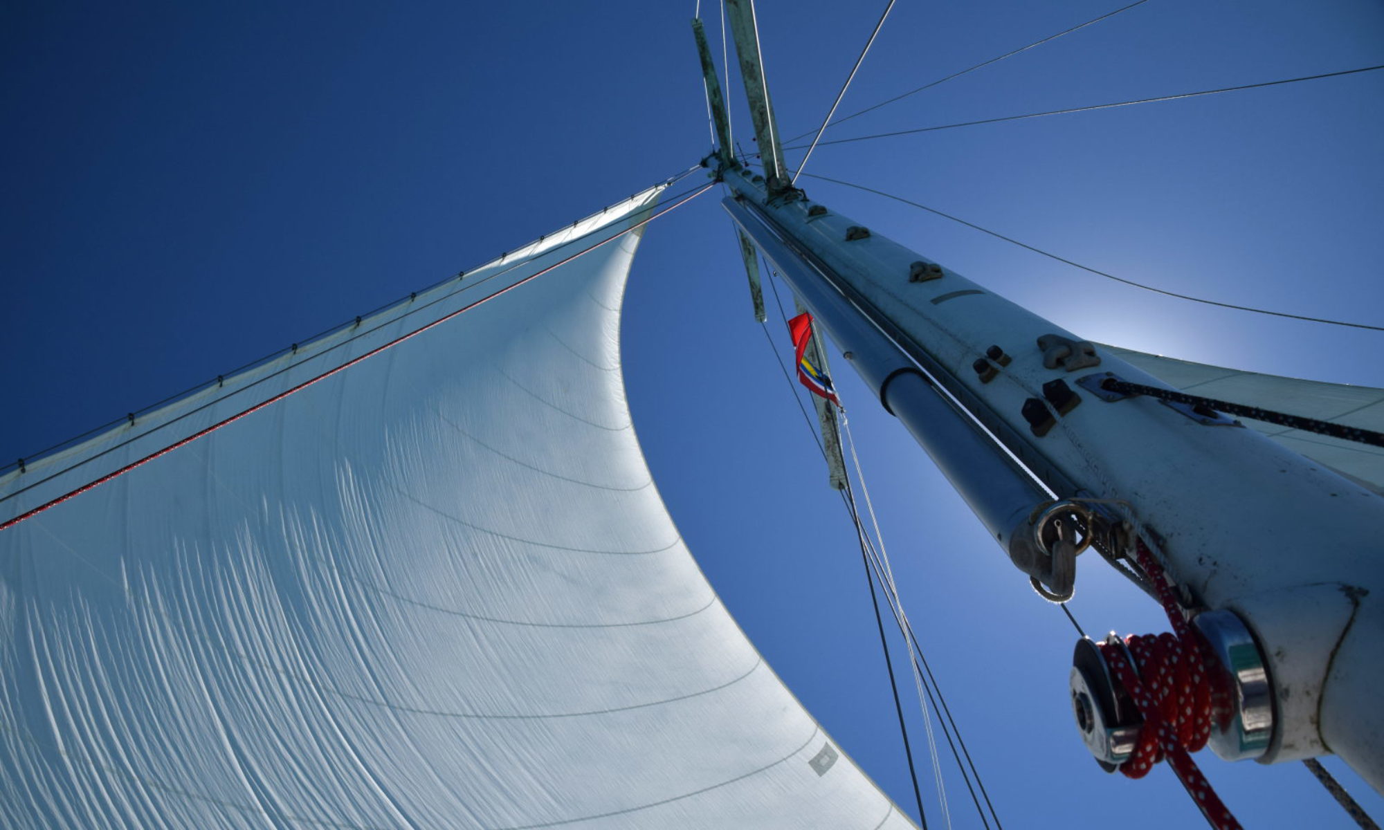
We had a big day planned – snorkeling, fishing, and diving. We took the dinghy out to find the reef in the morning – we couldn’t believe how gorgeous it was! The best part of the reef is smack up against the island and its rocks – we explored some of the outer patches but the reef was less stunning the farther out we went. The reef near the island was dense with coral, with lots of pretty sea fans, reef fish, and hogfish in 10-30 ft of water. Paul even spotted a tuna. Visibility was near 100 feet.

We snorkeled for a while, and when we hopped back into the dinghy, I saw a large silhouette pass beneath us. I hung over the edge of the boat and threw my masked face into the water to see – 4 eagle rays were gracefully swimming past! Paul immediately hopped in after them with the camera.

To scuba dive that afternoon, we picked a spot a little further north on the reef. It was only around 20 feet deep, but there were lots of coral heads and crevices to explore. We were greeted by big angelfish. Paul went to face to face with a curious grouper. For nearly an hour we went up, down, and around the coral heads.


When we turned around to head back to the dinghy, Paul pointed to something, his hand in a closed fist. Oh crap, I thought, I cannot for the life of me remember what that means. I didn’t see anything in that direction. I figured we were heading back, so maybe his closed fist was a navigational cue? But the thing was…. Paul kept checking over his shoulder….. and Paul NEVER checks over his shoulder when we’re diving. So nervously, I checked over MY shoulder. Still nothing. Maybe I’m paranoid…. nope, there he goes, looking around again. At this point, I knew what he was looking for, but without confirmation as long as we were under water, I could trick myself into thinking, nahhh, that can’t be it….
“Did you see the shark?” Paul asked as soon as we surfaced, at least 20 minutes later. It was far enough away that he could barely make out its shape, but even at that distance, it looked to be at least 7 feet long and was definitely NOT a nurse shark. The closed fist pointing was a danger signal – oh yeah, now I remember! I requested he hold his hand over his head like a fin to signal shark from now on! “People just don’t realize that every dive is a shark dive!” he exclaimed.


After that excitement, we took the dinghy out to some other areas for exploration. Eventually we passed into an area that I called conch city! Once we were in less than 10 feet of water, I started to jump in after them. It took us only 20 minutes to limit out. Here’s the thing about conch – they’re just too easy to catch! They poke their cute little snail-like eyes out of the shell, stare at you in fear, tuck the eyes back into their shell and start to run – at a pace of about 2 ft/minute. It just makes me feel guilty!

The next morning we did some fishing, but only got a little snapper that we tossed back. We jumped back in for some more amazing snorkeling. Then we took a walk on the island. Unfortunately, the end of the calm weather was coming, so we motored to Allans-Pensacola to tuck in for a few days.


On a side note, regarding food in the Bahamas: If those frozen burgers seem unusually and reasonably priced, there is a reason. The reason is that when they say it’s beef with “chicken filler,” they really mean it’s chicken filler with a little beef! They were seriously the grossest burgers I’ve ever tried to stomach. And we bought way too many of them. And with only grocery shopping about every 3 weeks, I knew we had to eat them. They are slightly more tolerable as meatballs than burgers. Just an FYI in case you ever make this mistake too.

We spent 5 windy, rainy, stormy days anchored at Allans-Pensacola Cay. We had wanted to explore this uninhabited island more after our short visit early in the trip.

We checked out the maze of trails – the signing tree trail beginning at the “free beer” sign is still the best. We continued our hunt for remnants of the US missile tracking station with some success – we found a set of stairs and what we believe was a radar mount. You can tell it’s been hidden by the brush for a long time because the dates graffitied on it were more than 10 years old.


Two Bahamian guys had towed a big, motor-less powerboat onto the beach. They were camping in it while they conched and fished. They told us there are at least 2 wells on the island. They let us take a photo with the huge sea turtle skull they found elsewhere on the island.

We met some American powerboaters who invited us to their bonfire that was later cancelled due to rain, so when they were gone the next day, we made our rounds to invite everyone else in the anchorage to “our” bonfire. We had limited success – 3 boats didn’t answer our “ahoys” – but we did get invited aboard one boat by a couple who were only briefly in the Bahamas but the boyfriend had been living on his boat for 18 years. We had some beers and some laughs, but the guy had too much pre-dinner tequila so they didn’t make it to the bonfire.
We were thrilled that another boat did join us on the beach once the fire was lit – the owners were fellow Tennesseans who had just bought their catamaran and had a captain along to help them learn the ropes of their new boat. The captain, who was younger us than us, had worked in Andros and Florida, so she was full of good information about diving in the Bahamas and the Florida Keys. We put out the fire just as the rain was setting in, and we got soaking wet trying to unload the dinghy. My logbook notes about that night say, “Paul was happy and singing rap songs” as we scurried through the rain, so I guess we were having fun!
My other note says, “Paul said the wind howled overnight, but I slept like a baby. Luckily this is a very calm anchorage.” Well, in this case, I spoke too soon….

When people express their worries about our trip, it usually involves sharks, or pirates, or the Bermuda triangle. However, my worry has been dragging anchor in the middle of the night during a storm, close to land, and having to be on deck of our metal boat with lightning striking.
After dark the next night, a thunderstorm set in. The wind suddenly picked up over 20 knots and our boat swung rapidly, putting us 180 degrees from where we’d first anchored days earlier. My eyes shot to the chartplotter. The alarm hadn’t even been triggered yet, but I knew: “We’re dragging!” I yelled to Paul. We were only a few hundred feet from the shallows and the boat was quickly picking up speed.
Instantly we sprang into action. Somehow, in the time it took Paul to start the engine, I managed to don shoes and padded gloves and got up on deck, trying to avoid contact with the metal as much as possible. In reality I have no idea if this would really help should lightning strike (Paul insists it wouldn’t do much), but I shouted to Paul to put on some shoes, when I saw that he was already at the helm – wearing only his boxers and sitting directly in a puddle of water on the metal seat.
I ran to the windlass and furiously pumped the handle back and forth, raising the anchor with record speed. When I saw lightning apparently strike the water miles off, I honestly screamed, “I don’t want to die!”
“The faster you go the sooner we get out of this shit!” Paul yelled back. Once the anchor was up, Paul drove forward, carefully, in pitch black with only the GPS and his memories of where the rocks lay for a guide. Paul aimed for a sandy spot in very shallow water. When there was only a foot of water left under the boat, he gave the command and I dropped the anchor with gusto. The boat drifted sideways for a nerve-wracking stretch of time until the anchor bit, and then our boat swung into line – and held! It was a miracle – this was our 3rd time anchoring here but the only time the anchor had set on the first attempt.

We looked around the anchorage and could tell by the lights and the crew on deck that some of the 8 other boats were dragging too, but there was no risk of collisions as long as the wind direction stayed relatively steady. We were setting alarms to wake up and check on things, when I saw a message from Other Paul, who was back in Florida. Florida had just been hit with 35 knot winds and boat-damaging waterspouts, and it was heading our way.
My adrenaline was still kicking from resetting the anchor in the storm. Now my mind started racing over what we should do to prepare for dragging again. Paul insisted that I was being overly fearful and there was nothing to prepare because there wasn’t much else we could do besides what we’d already done. To begin with, it was unlikely that we’d drag again. If we did and our anchor wouldn’t reset, we’d either end up aground, hopefully on the sandy beach, or be trying to motor out of the anchorage into the spacious Sea of Abaco. We would not be tossing in our second anchor (Fortress FX- 37), which is what I was asking about, because it would be harder to raise if needed, would risk tangling the other anchor, and stood almost no chance of setting in the grassy bottom. What he said made sense to me, but I could not convince myself that doing nothing was the best plan. What about just in case? It turned into a pretty fierce argument.
Finally, under the principle of having to give a panicked person something to do, Paul told me to ready the anchor as long as I promised not to throw it in the water under any circumstances. I debated if I should even bother, knowing he said this just to stop the argument. But thinking better safe than sorry I did it anyway, and I tried to think through what other actions I could take to prepare.
I checked the Facebook sailing groups to validate the forecast, and there were rumors that Chris Parker was predicting 40-70 knot winds (46-80 mph – yes land lubbers, Cat 1 hurricane starts at 74 mph). This was crazy! There was nothing but minor thunderstorms in the earlier forecasts (this was also months ago, so it was well before hurricane season if you were wondering). Once I saw that forecast, I knew then I wouldn’t be sleeping.
I stowed some of the sails below so they wouldn’t get shredded in high winds and to reduce windage. I closed the galley and head seacocks to prevent taking on water if the boat were to end up sideways in the shallows (though Paul later explained that our boat is set up so this wouldn’t be a problem like it is on many other boats).
Ultimately, this was the worst night on the boat – not because of the weather, but because Paul and I will never see eye-to-eye on what happened that night. We fell from our most glorious moment of teamwork into the ugliest moments of discord. He saw me as panicked and irrational. I later admitted that I was afraid (of course!) but I felt I was logically thinking through possibilities. I saw him as careless while he felt he had thought through the facts and had the most realistic plan.
In Paul’s defense he remained calm throughout the night. Actually, I think he slept a little too well. In later discussions he said simply, “We weren’t prepared for hurricane force winds and there was nothing we could do in that anchorage that we hadn’t already done to be prepared for that”.
Paul’s take on the situation was this:
It was a sort of checkmate scenario we were staring down. Several boats and shallow waters made making our way out of the anchorage in the dark highly risky at best. Even if we could make it out, there were no other anchorages around that we could navigate into at night offering better protection. Furthermore, our boat doesn’t have the engine power to make headway against 30+, knots severely limiting our options if we did go out into the narrow Sea of Abaco. In reality, we had the anchor dug in hard and deployed with the absolute maximum amount of chain we could deploy without putting ourselves on the beach. If the winds really hit with hurricane forces and our anchor gave out, we probably would have been on the beach before we could do anything about it. I knew that on land we would be wet and miserable but safe. There would be no need for the life raft, no weeks spent adrift at sea, no treacherous reef to tear us to pieces. Just a sandy beach and knee deep waters to wade through to get to safety. Knowing that if the worst happened we would be safe was enough for me, even if it meant we might lose the boat in the process. It was a freak storm well beyond what forecasts were calling for. We didn’t do anything wrong, but somehow we were out of good options and left only with the choice to take the least bad option.
I stayed awake until 3:30 am, and then I woke up every hour until sunrise, waiting for the winds to come.
Thankfully they never came.


