3:30 am: Alarm goes off. Decide to sleep for another half hour.
4:00 am: Alarm goes off: Get up. Check weather. Currently blowing up to 20 knots. The original plan was to start with a double reefed main (prepped last night) and staysail, but with this much wind, we decided to wait for daylight.
5:30 am: Alarm goes off. Still looks dark outside. Try to sleep.
We decided to immediately raise sail for stability. The wind was only about 10-12 knots, but we left in the reefs, raised the jib, and kept the motor running. In case of increasing wind, we didn’t want to be going forward to the bow in large waves and getting seasick while trying to adjust the sails.
As we pulled out of West End, Paul watched a huge tuna leap out of the water. Goodbye, Bahamas!
We headed southwest for 8 nautical miles – though in hindsight we should have gone at least 10 so we wouldn’t have to fight the Gulf Stream current so much as we approached Florida. The winds out of the southeast continued to be around 10 knots, possibly less, but the waves weren’t joking around, averaging 6 feet.
Waves never look big in photos!
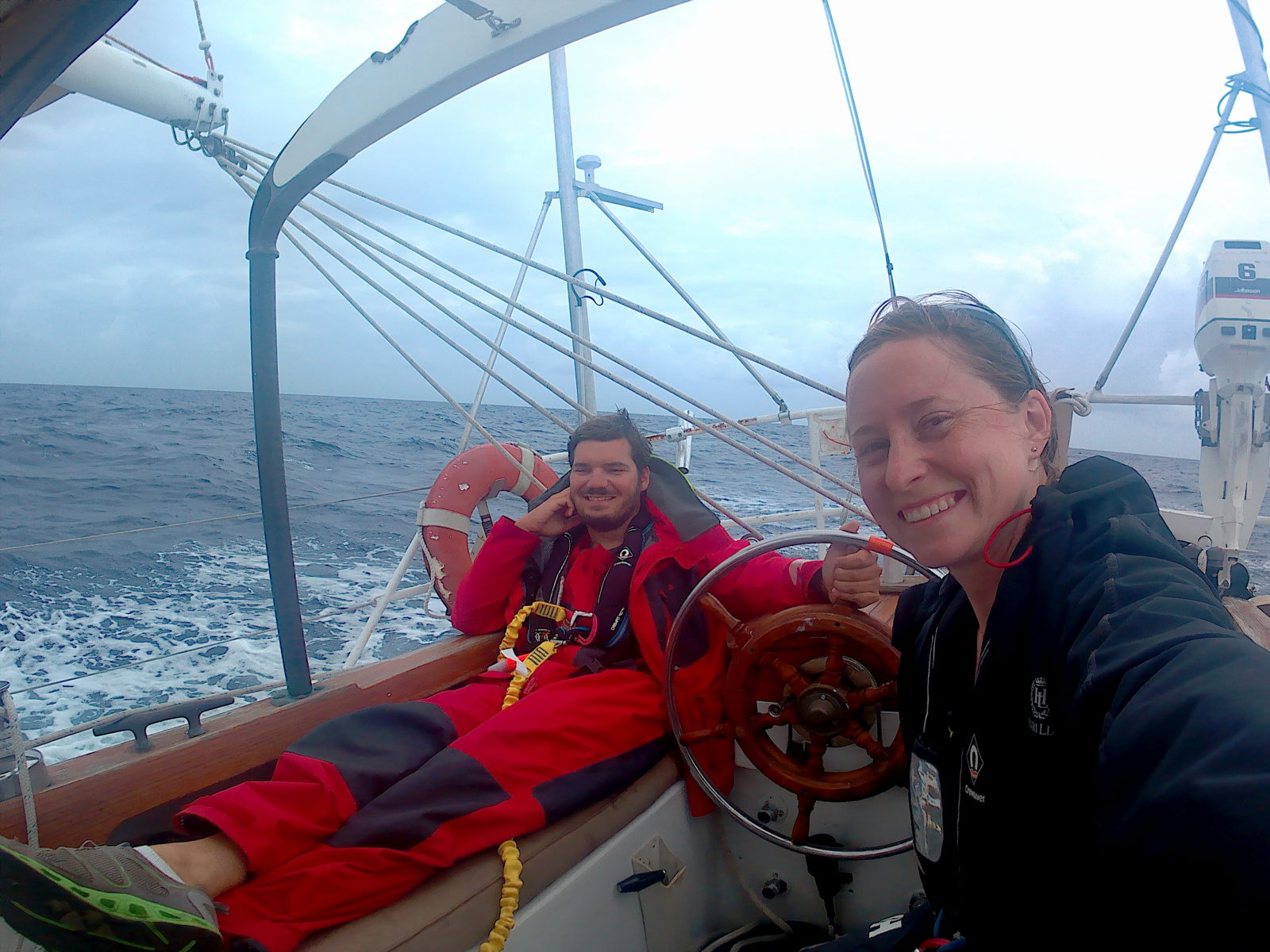
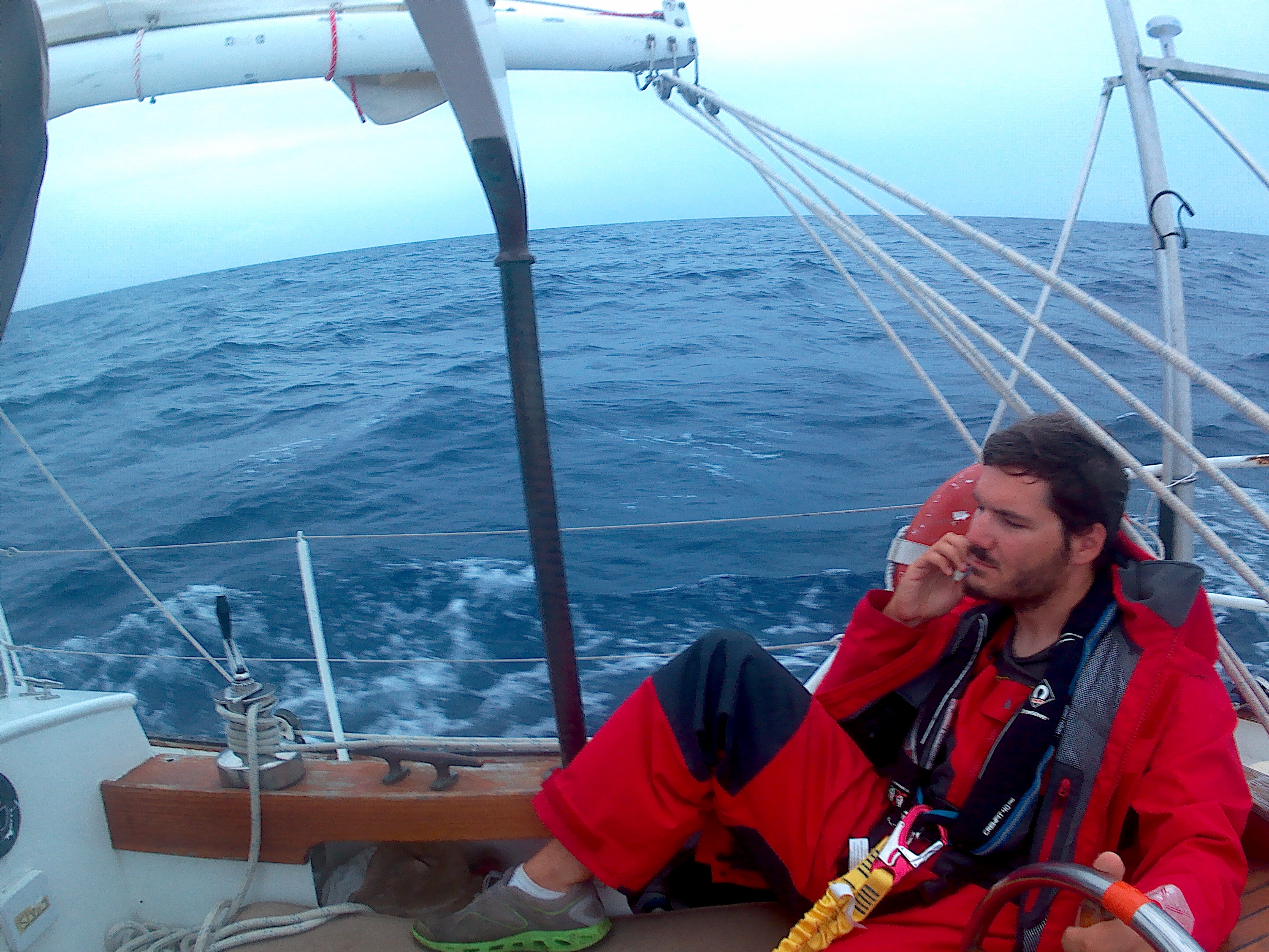
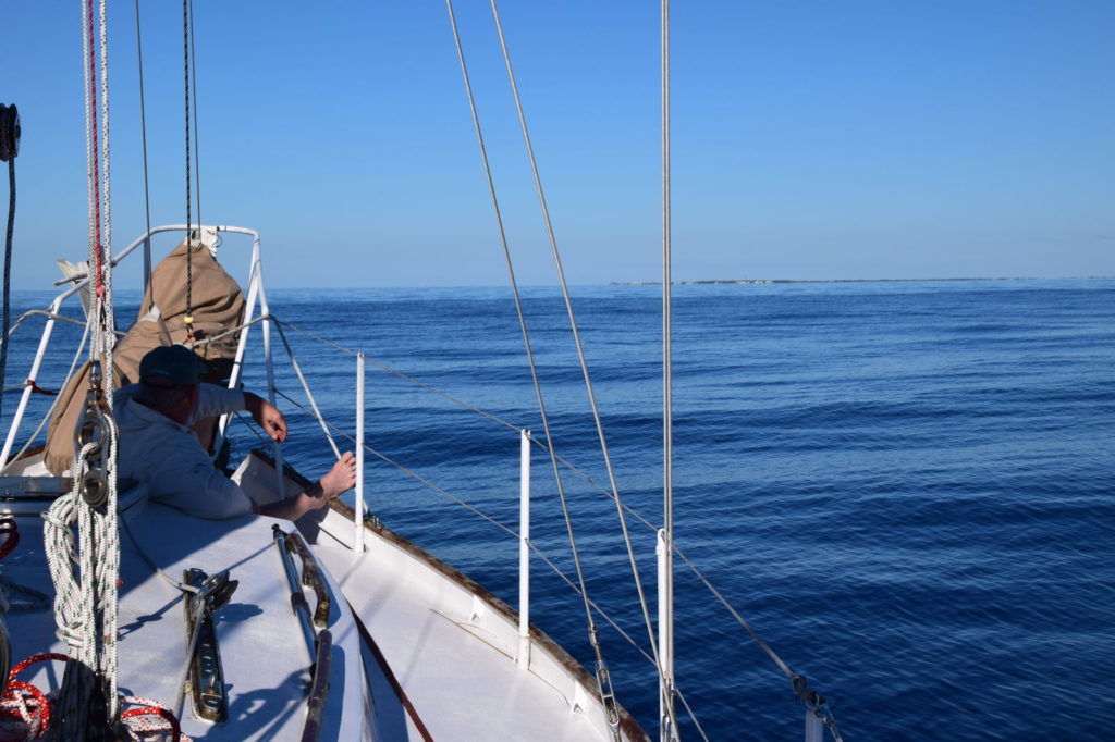
With the waves this big, steering took a lot of concentration, so we traded who was at the helm every hour. We both stayed in the cockpit for the whole trip, going below only to use the head (restroom). This was the first time I’d ever used a scopolamine patch for seasickness, and boy was I glad to have it!
We continued to see large waves even as the wind dwindled. And I started to think this was fun! A wave on the stern would occasionally get us wet and I’d laugh. I loved that in Gulf Stream the deep water looks royal purple, but when the top of a wave would start to foam, it would appear a bright, vibrant blue. I steered towards animal shapes in the clouds, and I couldn’t believe it when Paul proudly told me that I was doing a better job of steering than him.
Please note my expression…… versus Paul’s expression
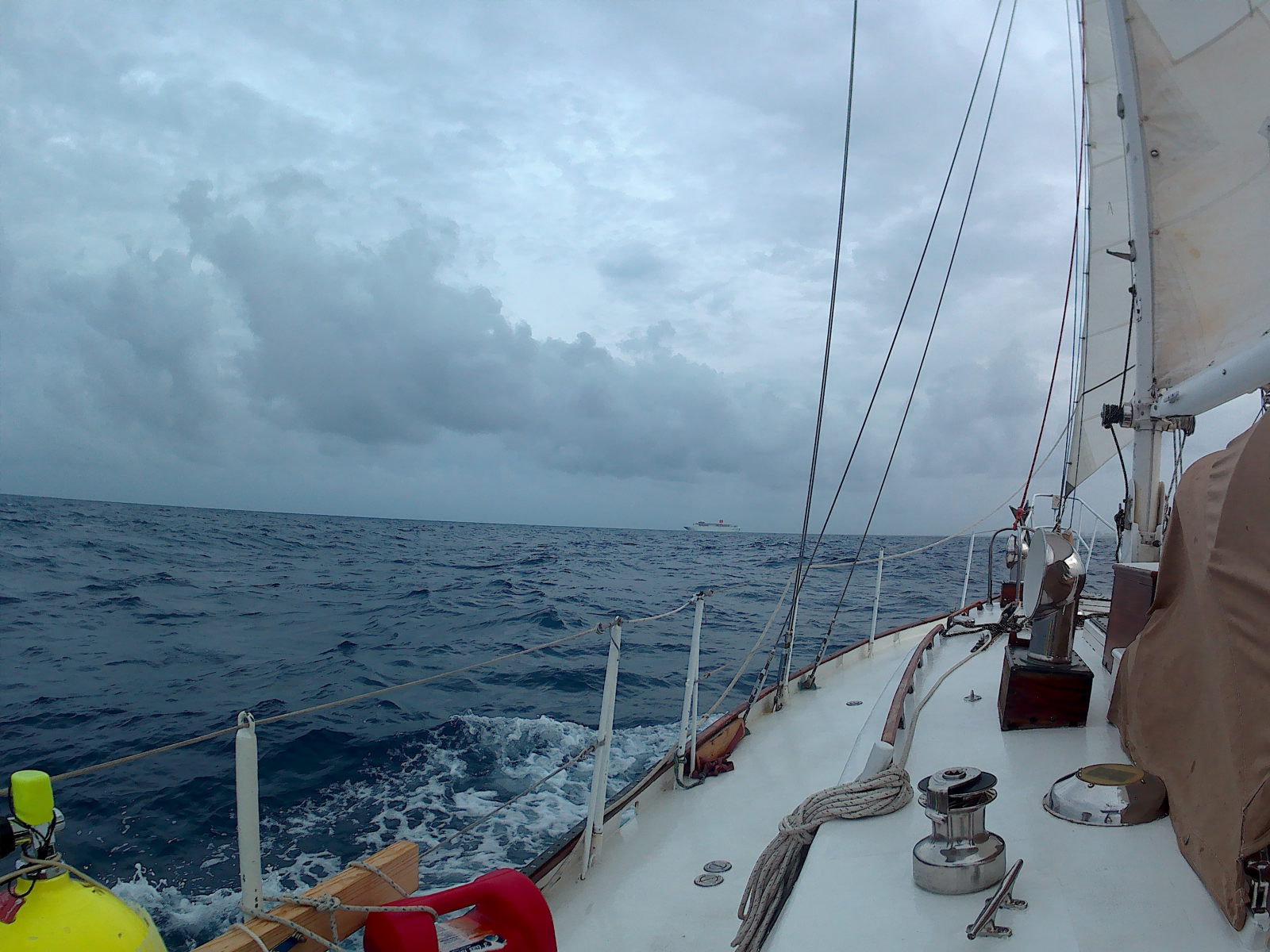
We saw 1 cargo ship and 1 cruise ship, and both passed several miles in front of us. A powerboat sped by us, and a sailboat was headed in another direction. At one point, I questioned if I saw a whale’s tail, but most likely it was a wave and my imagination. We watched some rain clouds in the distance, but luckily we didn’t get more than a little sprinkle.
Cruise ship ahead!
We did turn the motor off for an hour to slow us down, since the wind had picked up and the boat was speeding down the waves at over 8 knots. We probably should have considered putting up more sail when the wind dropped again, but things were going so smoothly motor sailing that we really didn’t want to disrupt our flow (or risk dropping below 5 knots, which we needed to average to be sure we’d reach Florida well before sunset). We waited until the last hour of the trip to take the reefs out of the main.
We were shocked how near to shore the Stream’s current was that day. We fought it almost all the way to the inlet. As we approached Lake Worth, our course over ground was West, but our actual compass heading was nearly South! It’s hard to explain how that messes with your head when you’re trying to compare where you are on the GPS to what you see in front of you.
Paul got quiet as we approached the inlet. He had prior experience with the inlets of Northern California and knew better than I that this could get ugly. And it was ugly – not just because of the water suddenly turning chocolate-milk-brown, but because the consistent 6-foot waves stacked up tighter and tighter at the entrance. I held my breath, praying the waves wouldn’t break over our boat, while Paul nervously but expertly steered down the middle of the rock jetties, as commercial ships chugged by and beachgoers naively observed.
In a just a few minutes, the waters calmed and we were welcomed back in the IntraCoastal Waterway. We lowered the sails and headed for the anchorage at the north end of Lake Worth.
“How big do you think some of those waves were?” I asked Paul. My thought was 8 feet.
“I bet some of those were 10,” he said.
“Really?” I was about to say that I had thought they were only 8 but I bet we could handle 10, when Paul cut me off.
“I wouldn’t want to do it again in more than 4 foot waves!” he exclaimed.
I countered, “Oh come on, that was fun though, wasn’t it?” He gave me a blank look. I prodded, “You have to admit that was fun!” He wouldn’t agree and he now thinks I’m crazy.
At the anchorage, we checked in to the US using the “ROAM” app, which was super easy and didn’t require us to leave the boat.
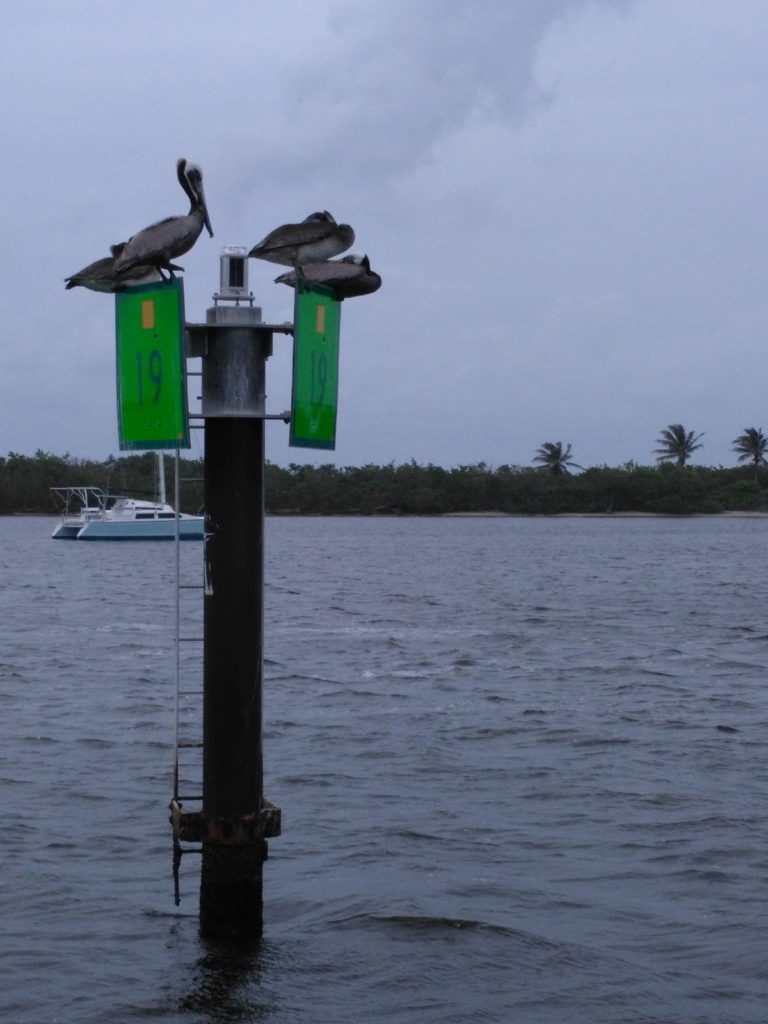
A 13 hour journey and we were home sweet home.
Pelicans welcoming us back to the US
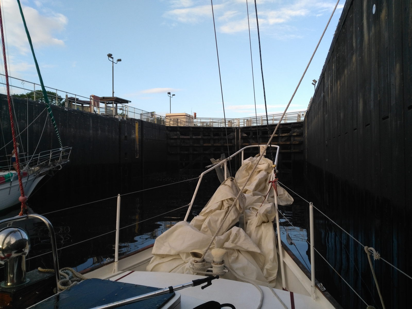
It took us two days to get to Indiantown due to the St. Lucie Lock schedule. Once at Indiantown, we prepped the boat to get hauled and moved as much of its contents into storage as we could. We also took note of how many alligators hang out in this marina and of how cheap the BBQ in town is.
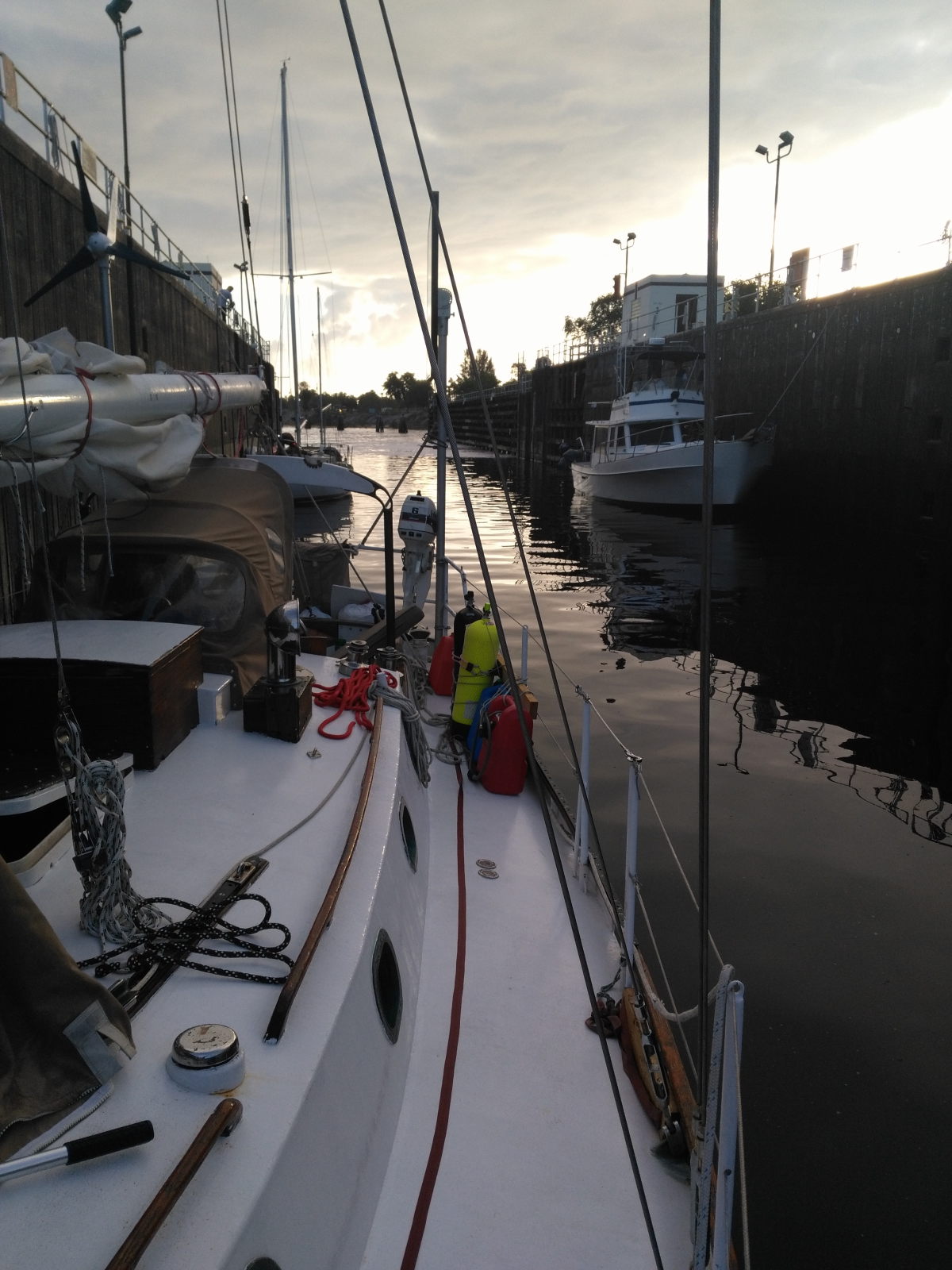
Entering the St Lucie LockEach boat’s lines are run around a cleat at the top of the lock – then you hold on tight as the waters rush in!
In just two more days, we said see-ya-later to Miss Fe and headed back into a life on land… but only for a few months, till the sea calls us again.
After a good night’s rest, it was up to me as captain to go ashore at Old Bahama Bay resort and clear customs. I also had a side mission to obtain a BTC sim card for our cell phone. Under Bahamas rules, only the captain of the vessel is allowed ashore to clear customs, so this was to be a solo mission. I launched my inflatable NRS kayak and began a rather long paddle to shore. The distance was short, only a few hundred yards, but the current was extremely strong and I was paddling dead against it to avoid being swept out to sea. My trouble was that the closer I got to shore the stronger the current got.
Eventually after a good morning workout, I made it to the beach and put my feet down into baby blue water and soft fluffy pink sand. “Paradise at last!” I thought to myself. Nobody was on the beach so I walked slowly towards the marina, taking in the beauty of the morning and the accomplishment I had just made. I asked the dockmaster and he quickly pointed me towards the customs building. Lindsey had done our research and I was prepared with:
Passports for each person on board.
USCG documentation (state registration ok if not documented)
Cold hard cash sufficient to cover entry and duty fees. It’s $350 for boats over 35 ft and $150 for boats under 35 ft. Bring at least $350 because we have heard rumors of boats between 30-35 ft being charged $350.
Having my documents in order, I entered a hectic room with half a dozen or so customs officials and numerous fishermen. I smiled and went to the first person that was open. He looked some things over and then left. “Ok..,” I thought. A few minutes later a lady came over and started signing papers and asked me to pay the cashier. I requested a spearfishing endorsement which is supposed to be free and provided on the cruising permit but she flat out told me no spearfishing (and we’re still not sure why – everyone else we’ve met got theirs). “Bummer,” I thought but at least I was charged only 150 for our documented 33 ft boat which was awesome as I have heard rumors others were charged more. The lady then handed over my cruising permit and said I was good to go.
“Thank you” I said “but don’t you want to stamp the passports?”. She looked at me puzzled for a moment then snatched the papers out of my hand.
“You didn’t see the lady and the other side of the counter first?” she barked.
“No,” I replied sheepishly.
“Go see her, and when your passports are stamped you can have your papers back,” she ordered.
Thinking myself a fool for cutting inline I gave my surroundings a good study as I walked over. All the uniforms were the same as best I could tell, there was no sign saying start here, and no line of any kind. How was I supposed to know where to start? Filling out the immigration cards went quickly though. They are the only thing that can’t be filled out in advance as they are carbon copies. With passports stamped I quickly collected my paperwork before anybody changed their minds.
Next I walked into the marina store and asked for a BTC sim card. “Sure,” said the cashier, ringing me up and handing me the card. Then another cashier chimed in and told me I couldn’t have it because they couldn’t sell me the minutes. “Can’t I just buy them off the BTC website?” I asked. “Nope,” was the reply as the card was snatched from me and my money returned. “Yikes, between spearfishing endorsement and sim cards people are kinda picky about making up their own rules around here,” I thought as I pushed the kayak back into the water for a rather quick drift back to Miss Fe.
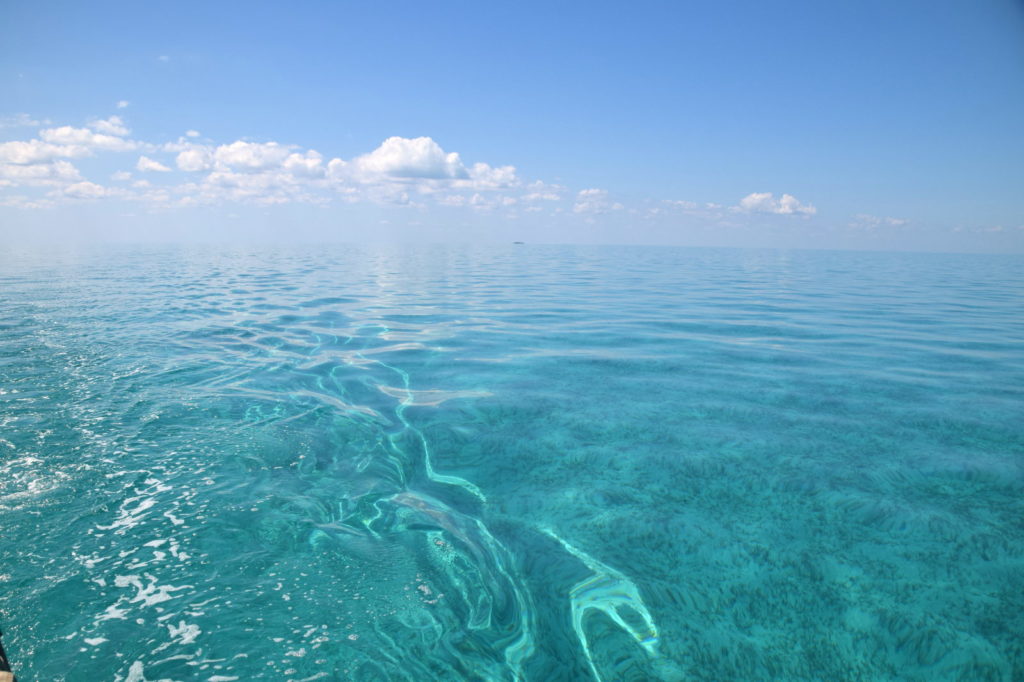
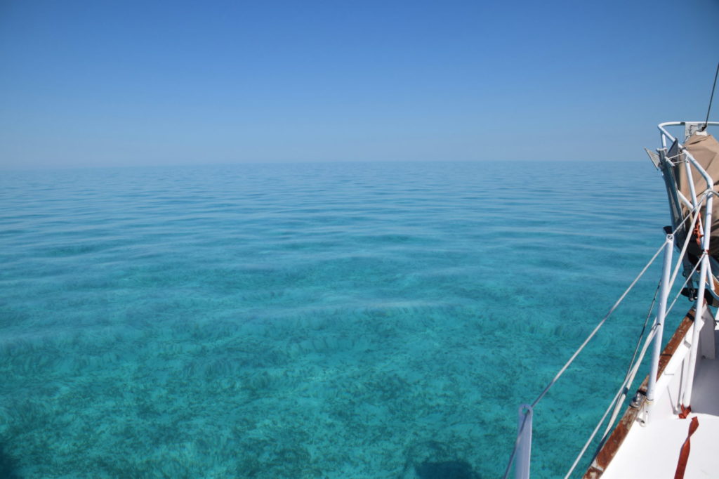
There isn’t really much in West End worth seeing so we hauled anchor and with no wind in sight motored onto the Little Bahama Bank. The first couple miles were through a somewhat narrow channel but it quickly opened up. The little Bahama Bank is really quite interesting topographically speaking. It’s a rather large area ~50 x ~30 miles, but it’s very shallow, rarely exceeding 20 ft deep. It’s more similar to sailing protected waters of a large bay, like say the Chesapeake, except most of the bank has little to no land bordering it. On a clear calm day in the middle of the bank, you cannot see land in any direction but you can see straight to the bottom as if it were a swimming pool in your backyard. We were in awe. After a while I turned to Lindsey and said “I’ve never seen anything like this; it must be God’s swimming pool”.
Gods Swimming Pool
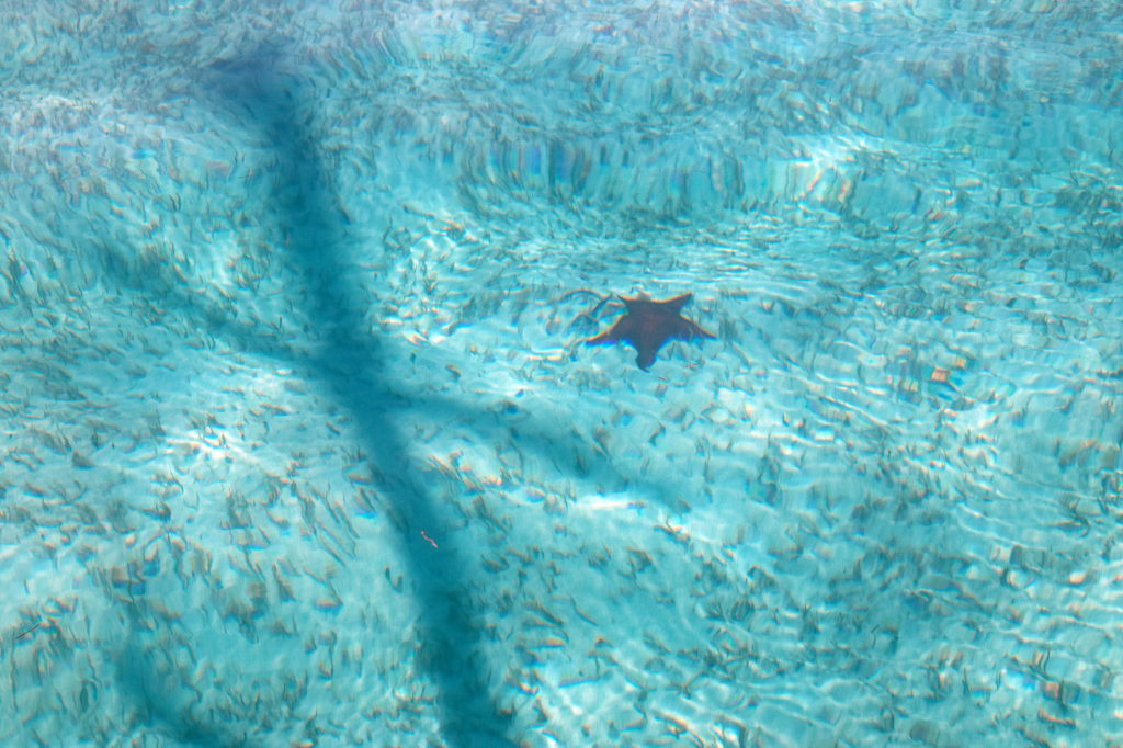
It was in fact so clear that we could even see starfish on the bottom as we passed by.
Starfish!
It was a rather quiet day as we all sat on different parts of the boat quietly taking in what we had accomplished. The crossing had been tiring, weather and other obstacles were no doubt ahead of us, but it didn’t matter. All that mattered was the moment we were in and trying to soak up as much of it as possible before it disappeared.
As dusk came we anchored at a small island called Mangrove Cay. It wasn’t very inviting so we payed it little attention. In the morning we pulled out our charts and decided to attempt to get to Walker’s Cay some 20 miles to our north. Walker’s Cay is unique for several reasons. It’s the northernmost island in all of the Bahamas and while once a thriving marina and resort, it now lies in a state of abandonment listed for sale since a hurricane forced its closure in 2004. It was also well known for shark diving and big game fishing.
Quiet day bound for Walkers Cay
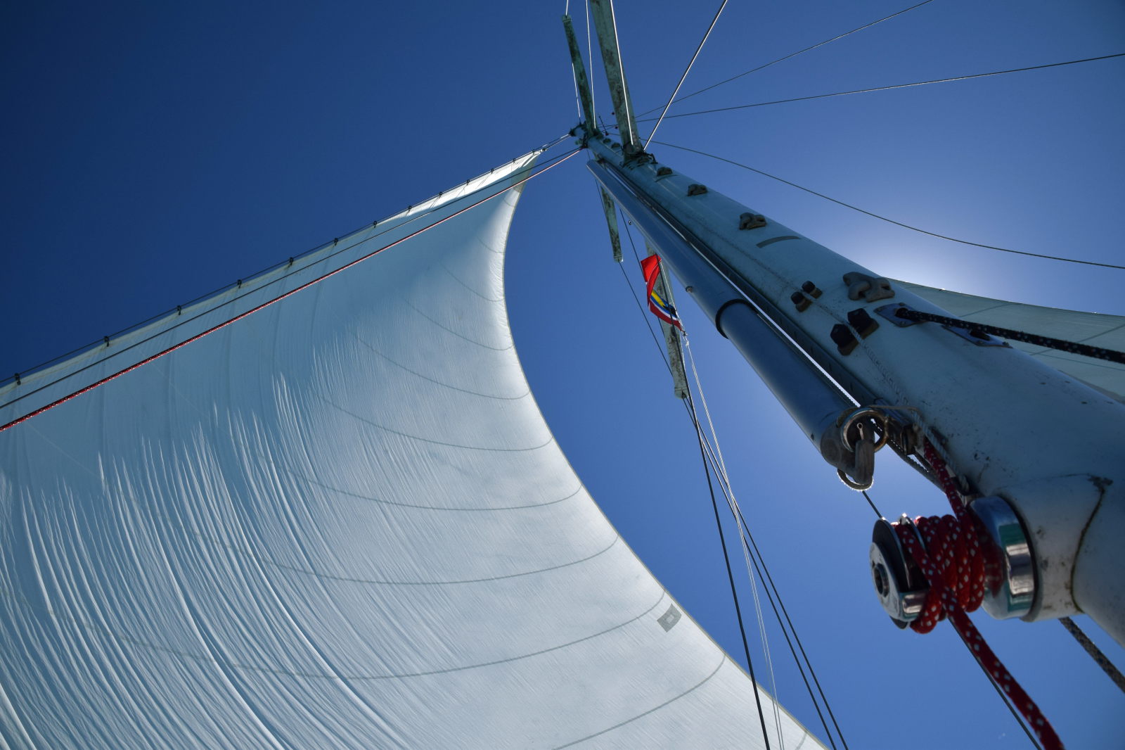
The sail towards Walkers was great. For one thing, it was the first time we had the sails up since NC (2.5 months earlier!). In addition, we had great wind and with the genny up we were regularly making 6-7 knots. We also had some visitors: With no land in sight, a little bird landed on deck to keep Dave company for a while, and we also spotted our first Bahamian dolphin.
Dolphin
As we approached the old channel to the abandoned Walkers Cay Marina I had a change of heart. It was narrow, hadn’t been maintained in over a decade and just gave me a bad feeling. With nobody else in love with the looks of it, we diverted over to Grand Cay, just miles to the south, which has become the northernmost settlement in the Bahamas with Walker’s closure. We arrived at Grand Cay in time to bust our the dingy for the first time and take a quick evening trip ashore. We didn’t even bother to bring a camera, thinking we would be back the next day. We (well, Lindsey and I) had a good laugh on the way to town as Dave’s clean shorts got soaked with water. Note: Don’t put the big guy on the bow of the dinghy!
What we found on Grand Cay was a real slice of “the old Bahamas.” A small community of ~400 people. No ferries or airports service the town so the only visitors come by boat. The docks looked run down but were full of fishermen returning from a day out. The streets are uneven cement wide enough for one golf cart to pass. The beer was reasonable at $3 and it was our first taste of some very fine seafood salad (in the Bahamas seafood salad, or conch salad, is very similar to ceviche but without chips and often with the addition of orange juice. As with ceviche the seafood is raw.) The bar (an outdoor gazebo with picnic tables and the salad cart nearby) was hopping with locals of all ages – one guy told us Sundays are family days. Dave and Lindsey made a point of walking the town and were not disappointed when they found waffle cones filled with bourbon cherry and rum raisin ice cream at a little shop.
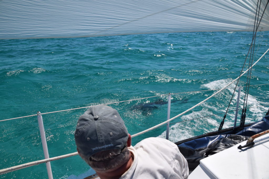
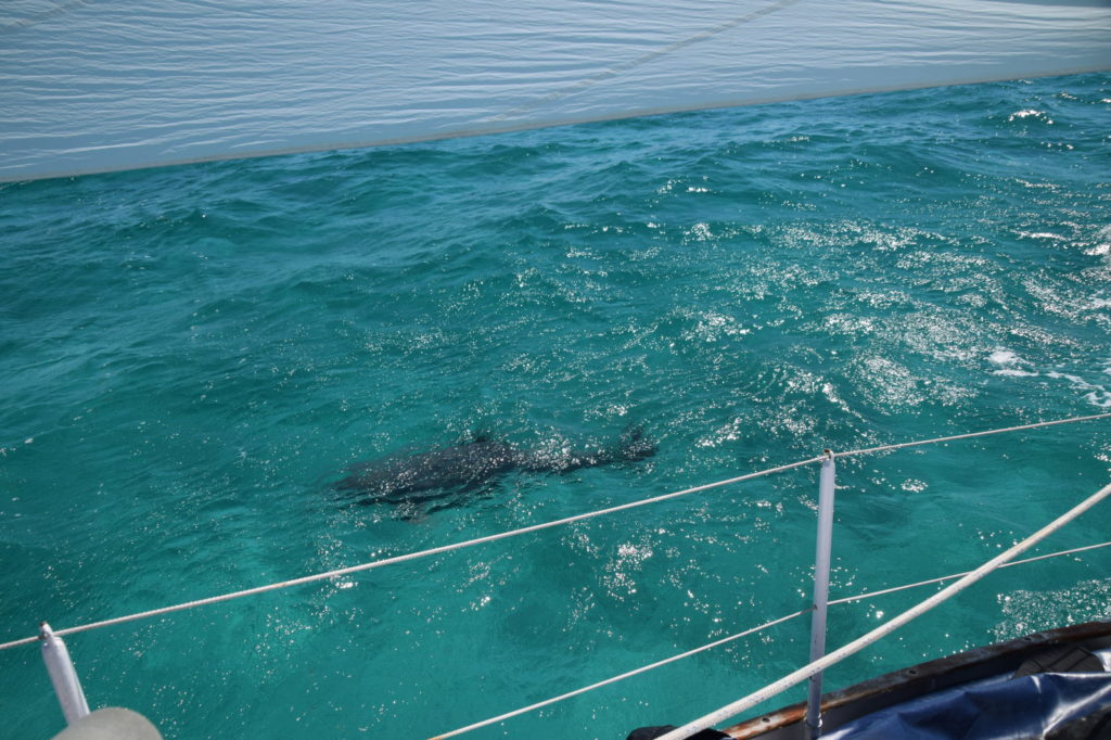
On the dinghy ride out of town, we made Lindsey sit up front. It was starting to get dark but we saw the silhouette of something rise out of the water a few yards ahead of the boat. We were trying to figure out what it was, when all of a sudden – SPLASH! – Lindsey got drenched. I quickly diverted my light to identify the culprit, and lit up the beautiful spots of 2 eagle rays swimming by!
When morning came I was up at 6:30 to listen to Chris Parker’s SSB weather broadcast. Since I wasn’t able to procure a sim card yet, it was our only source of weather and the forecast wasn’t good. Chris was calling for a gale out of the west in less than two days time. We were anchored completely exposed to west winds so I quickly shook Lindsey awake. “We gotta go babe, can’t stay here!”
As we got breakfast going we poured over every anchorage for 30 miles. Westerly protection was very hard to come by. As morning drew on we tried several anchorages around Grand Cay but the holding was no good. We even assembled our storm anchor, a Fortress FX-37 as big as Lindsey but it wouldn’t hold in the grassy seabeds. Disappointed, we agreed to set sail for Great Sale Cay 20 miles to our south. On the way there still wasn’t much wind but we did manage to motorsail and find a 4+ft loggerhead sea turtle to keep us company.
Loggerhead Seaturtle
Great Sale Cay is a large island in the middle of the Little Bahama Bank. Though there are some 1960’s ruins, it is completely undeveloped with the only visitors being boats looking for safe harbor. Thankfully it offers two large harbors with westerly protection, just what we needed.
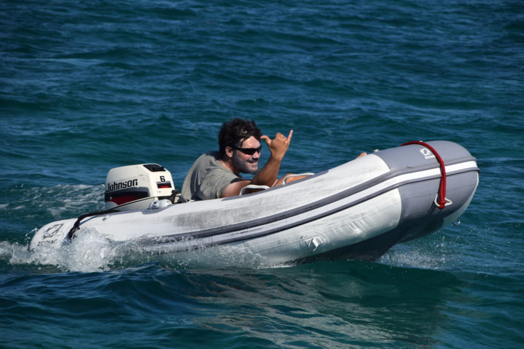
Paul playing on the Zodiac
The next day was clear as forecast and we took full advantage snorkeling and walking the remote beaches before the storm set in. We saw sting rays, barracuda, snapper, jacks, and various little tropical fish. As the day progressed, about half a dozen boats arrived to take cover with us. We made a good call with Great Sale as it provided cover while we were pinned down for the next day. By the third night the winds had subsided a little down to about 20 knots and we were up for an island with a bit of nightlife!
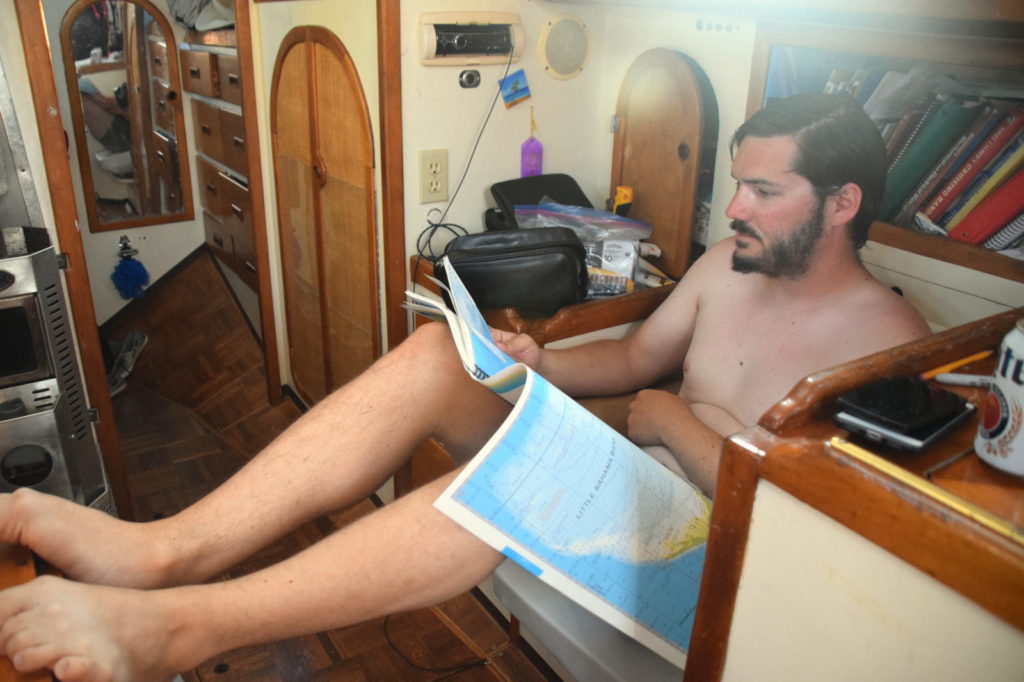
Paul picking our next destination!
Talking with a little catamaran named Toucan they had great things to say about Allans Pensacola Cay and Green Turtle Cay. We wanted to go directly to Green Turtle since it is populated but figured it was too far so we made a stopover at Allans Pensacola. With the strong winds we had a very enjoyable sail.
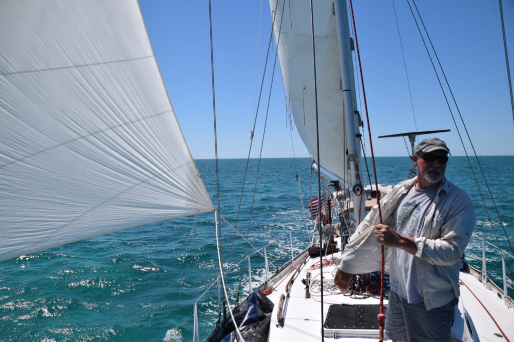
Dave enjoying our first good sail in the Bahamas.Good to have the sails up.
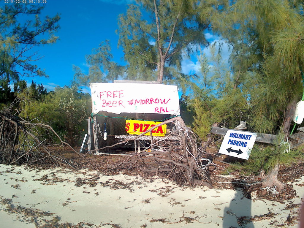
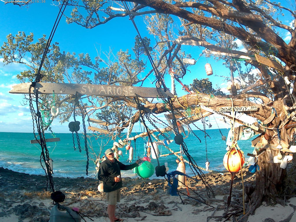
Our time on Allans Pensacola was short but we did have time to hike across the island to the famous signing tree, where visitors leave dated signs with the names of vessel and crew. We hunted for the remnants of the US Missile Tracking Station that was once on the island, but found only the asphalt of a former road.
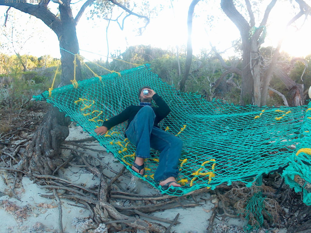
The signs marking the trail head. Always a day too early for the free beer!Dave checking out the Signing Tree at Allans Pensacola.Paul enjoying the signing tree beach at Allans Pensacola
The next day we were up early and bound for the civilization of Green Turtle Cay.
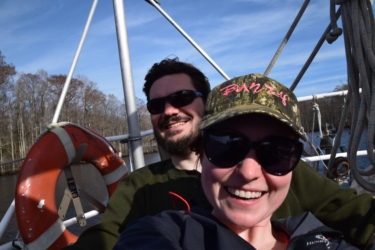
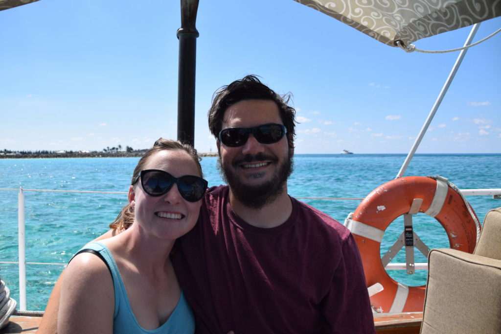
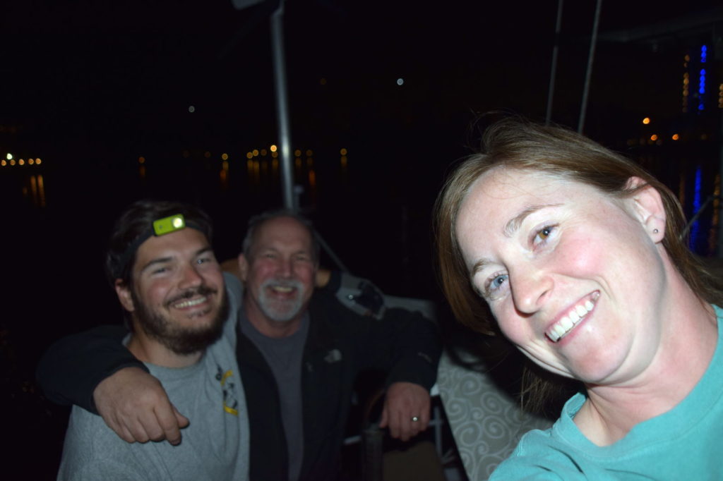
The three musketeers ready for a Gulf Stream Crossing
We had a fun filled week at Cooley’s Landing. We made new sailor friends, tried out all the local sailor bars, and got to spend time with our Florida family. We also completed some minor projects (like replacing a hose for the head, oh joy!). On the down side we were boarded by an infamous pirate, no joke. We threatened trial and hanging, but he insisted he was just inspecting our vessel for stowaways prior to departure.
Pirate on board!Told you he was an infamous pirate
All joking aside we enjoyed our time at Cooleys Landing immensely and had made some good friends while there, but Ft. Lauderdale was a pit stop for us, not a destination.
While at Cooleys we would wake up at 630 am every day to listen to Chris Parker’s weather forecast. Chris broadcasts forecasts for the Bahamas and Caribbean via SSB (marine shortwave radio). These forecasts are extremely detailed and tailored towards boaters. He charges a fee if you would like to ask questions but you can otherwise listen for free. We listened each morning only to be disappointed with large seas and high winds forecasts. Finally on March 12 Chris mentioned things might be calming down later in the week. I scoured my usual sources for weather (Windy and NOAA) and it looked like there would indeed be a possible break in the weather. Normally this would have been enough but several other factors came into play, which made us take our weather forecasting up a notch.
The Gulf stream is a strong north flowing current that we would have to spend a significant amount of time in. If weather conditions aren’t right, it can be down right horrible in any size boat.
My dad David would be coming down to give us a hand with the crossing and spend a couple weeks exploring. He was buying a last minute plane ticket so any delay in our departure would mean less time in the Bahamas for him.
With all this in mind, I sent off a quick email to the folks at Weather Routing Inc (WRI) asking for a custom forecast for the weekend, using a coupon we had received at the Annapolis boat show. WRI has a team a meteorologists forecasting marine weather around the globe 24/7/365 for everything from small boats like us to giant oil tankers. Within hours they provided us with a very detailed report, which you can download here. They also offer phone consultations, which we will probably try out when we return to Florida. I can’t recommend WRI enough if you are taking a long passage and need really accurate weather information. With the forecast being excellent I made a quick call to my dad and told him to buy his ticket since we would be leaving Friday morning at about 1:00 am.
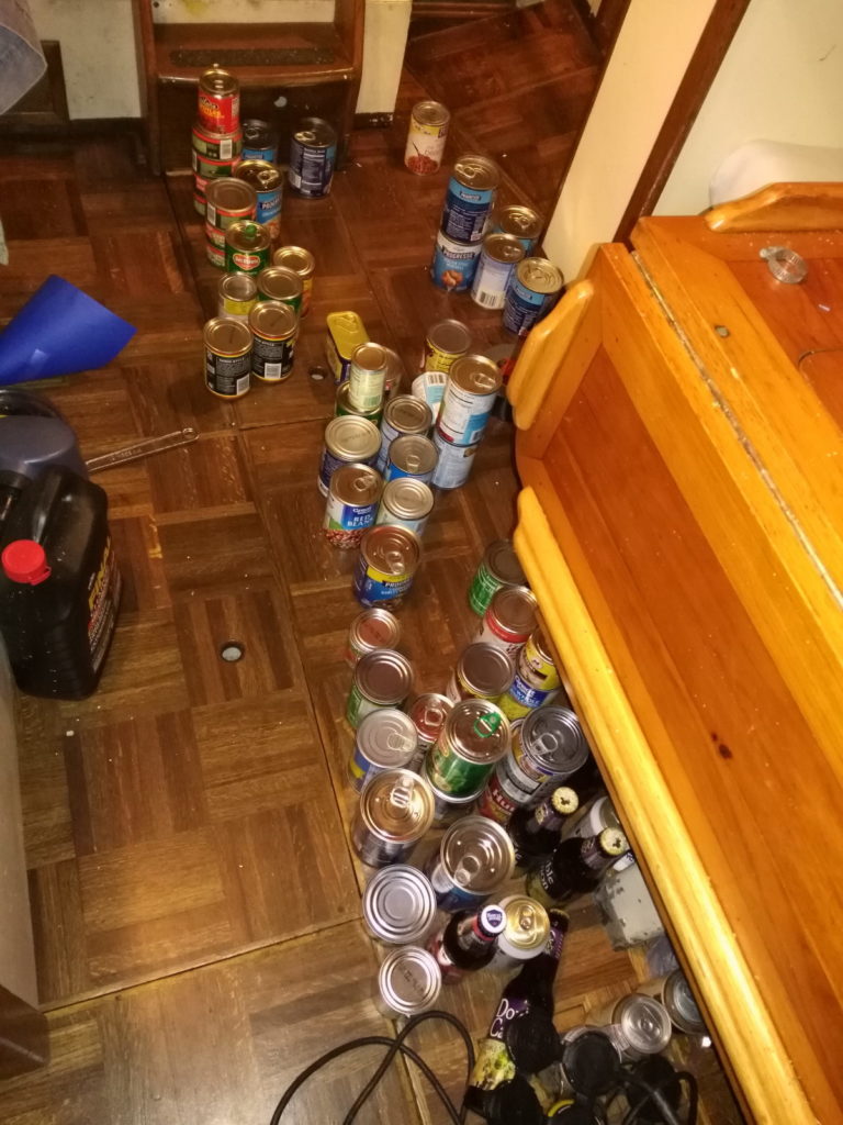
A small portion of Miss Fe’s provisions
After a not-so-quick trip to Walmart and the largest grocery bill either of us had ever had, we were set to go – except we could not depart directly from Cooley’s Landing due to the extreme currents that had already rattled us getting in. So Wednesday afternoon we ran the New River gauntlet but this time we were a bit wiser than last time. We waited until the current was completely slack and then went for it. We cleared the first bridge with ease but just as we did the blasted railroad bridge closed on us. We were trapped again between two bridges.
We were treading water when a mega yacht crackled on the radio that they were coming through the first bridge. “Lindsey, starboard tie,” I hollered.
“What?” she said, “We’re doing great right here.”
“Time to play it safe. There is a beautiful public dock we can tie off to and avoid playing bumper boats again.” So we tied off and waited. By the time the damn railroad bridge opened, we were in the company of 2 very large mega yachts. Since we were docked we passed through the bridge last. The yacht in front of us told the next bridge operator that we would like to pass as well, and the bridgetender replied he would “clear traffic and get it open in a moment.” This is the same 300 yard section we had trouble in last time. Not trusting that “in a moment” meant any short length of time, I yelled, “Port Tie, Port Tie,” and we tied up to a random restaurant’s dock, nervous to be here again but safe and undamaged.
We waited and waited for the bridge opening, and as we did, a very large sportfisher (~70-80) also pulled in behind us to wait. “What the hell is wrong with these bridge operators? We have 4 boats crammed in with probably less than a 100 feet between us. Are they trying to cause an accident?” I said to Lindsey. Luckily all 3 of the other boats were equipped with bow/ stern thrusters so they managed to hold position without hitting anything. It was without a doubt some of the best maneuvering I have ever seen any boat do let alone 3 at once. After another 20 minutes of sitting tight, the bridge opened, we pushed off the dock and we were free at last, sort of.
Our anchorage options were pretty bad in Ft. Lauderdale, with only 2 options. We choose Lake Sylvia which is less than a mile from New River. Boats were crammed in like sardines, and it was the tightest we have ever anchored. We set our anchor alarm for a distance so short that inevitably even a small windshift would set off the alarm, making for a long night. But the boat was safe and we were ready to cross, except we still were missing a crew member.
Due to work commitments, my dad David left TN Thursday afternoon after we were already anchored out. Not wanting to setup our dinghy only to have to take it apart again, we asked our friend Ryan at Cooley’s if he would be willing to shuttle David out to us in his rather spiffy 20hp dinghy. Ryan quickly agreed, and on arrival David found him at the marina ready to go.
They bailed the recent rainwater out and started up the dinghy, going about 100 ft before it died. Again and again, they kept starting it only to go a few hundred feet before it died. After about an hour I texted David, “Everything ok?” to which he replied,”Motor trouble”. Uh oh, I thought, swift current and no motor would make for a bad ride. Luckily they troubleshot that the fuel pickup was not doing its job so my dad had to tip the half empty tank at an angle for the duration of his trip. After a 5:30 am start to his day in TN, our third and final crew member was onboard at 8:00 pm, just 3.5 hours before out departure time. We had a beer, swapped some stories, and tried to get about an hour nap.
At 11:30 pm I turned on the radio and woke everybody up to The Struts “Could Have Been Me”, followed by some CCR, Zac Brown Band, and Chris Janson. We rushed to complete our final preparations, determined to get the anchor up before midnight, while it was still Thursday – it’s considered bad luck to leave for a passage on a Friday.
Everybody was in good spirits and ready for a 12 hour ~70NM ride to West End, The Bahamas. The anchor came up without issue, the motor started right up as usual, and we glided out of the overcrowded anchorage with a smart look on our face. “This is going to be a piece of cake” we thought.
We had one drawbridge to clear, but with a closed vertical clearance of 55 ft, we wouldn’t need it to open. To be on the safe side, Lindsey called the bridge well in advance asking to confirm the height. The bridge replied, “Due to insurance reasons, I cannot tell you. You’ll have to read the gauge on right side of the span.” Laughing, Lindsey pulled out the binoculars and waited until we were close enough to read the gauge – 56 ft – full steam ahead!
Thirty minutes after departing the anchorage, we were exiting Port Everglade. The sky ahead was dark and full of stars while the city lit up the horizon behind us. There was very little boat traffic, and we were relieved that there were no large commercial vessels nearby. Gentle 3 ft rollers started to rock the boat back and forth, and our speed under motor dropped into the 3-4 knot range. With only 18 hp but 28,000 lbs, even relatively calm seas can slow our boat down when motoring.
A couple miles offshore as the lights of Ft. Lauderdale were fading, I sent Lindsey below to take the first break. Shortly thereafter I noticed the engine temp was climbing higher than I like, and we were making black smoke. Not good, but its hard to get the prop pitch right at night when everything is dark. I adjusted it as best I could and gave everyone strict orders to check the temp at least every 15 minutes.
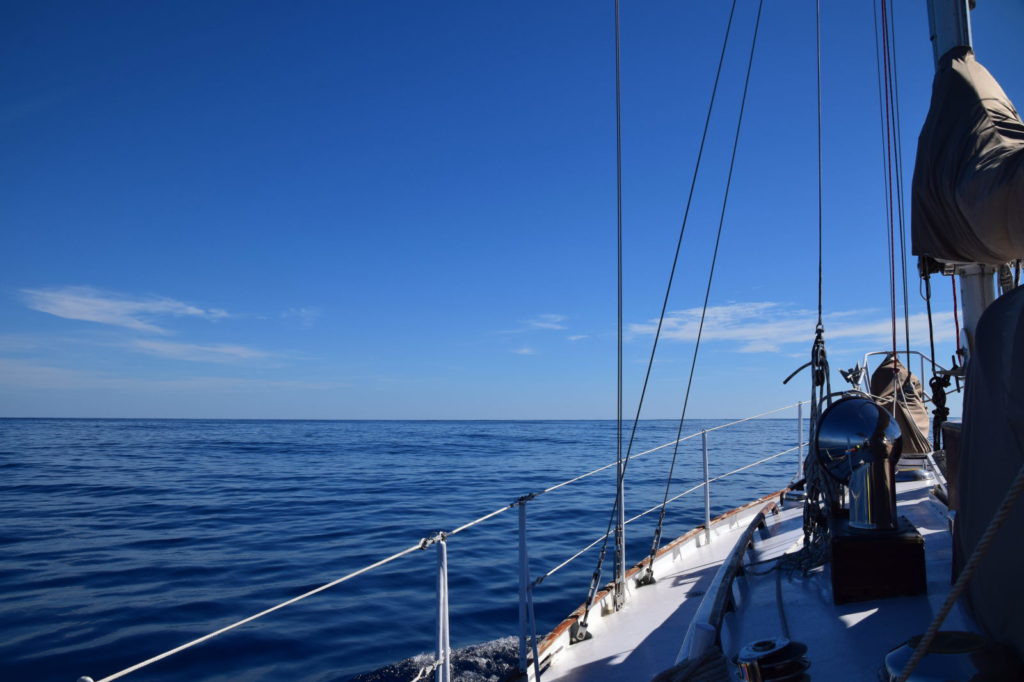
Now this would have been the time to put up our sails and make 6-7 knots, but we had one little problem. We were so focused on a smooth crossing that we picked a day with smooth seas but no wind. I mean nothing. There was so little wind it would have been completely hopeless trying to fill a sail with it. Before I went down at the end of my first shift I looked at the ETA on the GPS. It said 7 PM arrival. Not possible, I thought. At daybreak the winds will set in, we will kick some ass and be having conch fritters by noon. Not so, my friends, not so. As a side note, the stars were incredible as the lights of Florida faded and the flying fish were out in force. It was spectacularly beautiful calm night. Sometime during the early morning hours we entered the gulf stream. The motor was running as hot as I would tolerate, but at least it was holding steady.
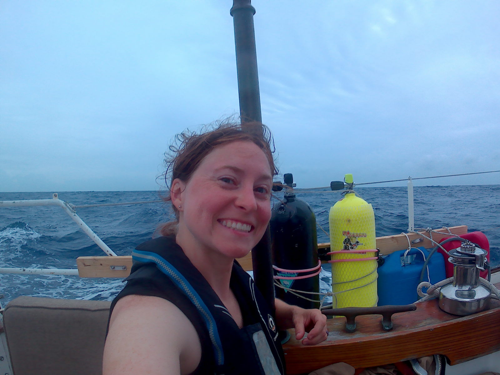
Lindsey’s notes: After a couple hours of sleep, I donned my harness, clipped myself into the cockpit, and took the helm so Dave could rest below and Paul could have a break from steering. The watch schedule we had decided on was 2 people on watch at all times, rotating a person out to rest every 2 hours (which means your watch shift was 4 hours). Even though the swell was small, the boat was rocking pretty good and it’s hard to quell the queasiness in the dark without a horizon to look at it. My watch consisted of steering, hopping up every few minutes to do a 360 check for other boats, and counting down the time until there would be light. My biggest concern for this trip was ships, but luckily we saw very few, and the ones we did see were far off and heading away from us. We were running a bit north of our rhumb line, but Paul warned me not to steer too far east while we were still in the Gulf Stream as our speed would drop below 2 knots if I did, and at this point we were still hoping to make it the The Bahamas before sunset!
Morning in the Gulf Stream
Finally, when I started my second shift, daylight had arrived. Yet there was still no wind. The windex (wind direction indicator) spun slowly in circles, aimless. Lindsey kept an eye on the wind generator, hoping for any sign that we might get to sail, but the generator’s blades remained still for the rest of the trip.
Glancing off the bow I noticed scattered but frequent clumps of sargasso seaweed. I hoped, in vain, that a Tuna or Mahi would be hanging around one of the larger clumps. I dragged a lure behind the boat on a handline and even detoured towards the weeds a couple times hoping for a bite.
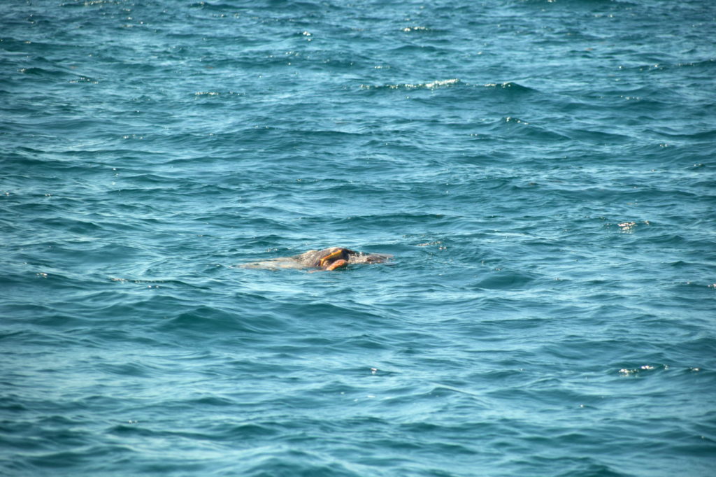
To my surprise I also noticed many Portuguese man-o-war, a pretty jellyfish-like creature that looks like a floating blue balloon and packs one hell of a sting. No swimming in the gulf for us today, I thought. As the day drew on we all took naps and had a few snacks. Without sails up, the boat was a bit rolly and nobody had much appetite for more than ginger ale and crackers. It was beautiful out there though and a nice break from the hustle and bustle of South Florida. The feeling of adventure was setting in for all of us. Hour after hour went by, and there was nothing but deep blue water to keep us company.
Finally late in the afternoon we spotted the water tower at Old Bahama Bay Resort. Since the weather was forecast to be calm for the next few days, we anchored outside the marina in a rather exposed anchorage, just as the sun was setting. 19 hours had passed since we raised our anchor in Florida but it was so worth it – we made it to the Bahamas!
Land ho!
The next day, despite the ridiculously strong current in the anchorage, I dove in with a snorkel to see if a fouled prop had caused the engine to run hot. It was clean as a whistle. Going to the next option, I checked the strainer sure enough it was partially clogged. Note to self: check the strainer, check the strainer, check the strainer….